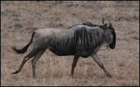
Tracking Animals throughout the Athi-Kaputiei Plains
 Below are the total distance traveled of all the animals we are currently tracking throughout the Athi-Kaputiei Plains and the Nairobi National Park region of Kenya; the distance within parentheses being the total distance traveled within the last week.
An overview map of these animals from the Athi-Kaputiei Plains is also available. The animals being tracked are:
| Total distance | |||||
| No. | Collar | Name | traveled - km* | Last checked-in | |
| 1 | 02840 | Sotua | 1630.93 | (0.00) | January 6, 2012 |
| 2 | 02842 | Laingoni | 2472.16 | (0.00) | January 15, 2013 |
| 3 | 30068 | Ole Nagol | 323.15 | (0.00) | November 2, 2012 |
| 4 | 30070 | Sawani | 1045.92 | (0.00) | August 2, 2011 |
| 5 | 30071 | Peria | 2794.74 | (0.00) | January 11, 2013 |
| 6 | 30072 | Paita | 2446.25 | (0.00) | January 15, 2013 |
| 7 | 30074 | Noontare | 2919.53 | (0.00) | January 15, 2013 |
| 8 | 30077 | Ntishya | 3221.43 | (0.00) | November 20, 2012 |
| 9 | 30079 | Kikaya | 3051.62 | (0.00) | October 17, 2012 |
| 10 | 30082 | Kiranto | 2567.31 | (0.00) | January 15, 2013 |
| 11 | 30084 | Karbolo | 1802.72 | (0.00) | January 13, 2013 |
| 12 | 30086 | Ne Mpaash | 1650.75 | (0.00) | January 15, 2013 |
*Notes: Distance is a conservative estimate, summarizing the straight line movement between locations. Distance within parentheses "()" represents distance traveled within the last 7 days. 1 kilometre = 0.62 miles.
The collars from all animals have now stopped sending GPS positional information. Movement data will not be updated.
Last update: September 28, 2013 at 02:37:56, Colorado time. Checked-in times are Kenyan, and so may be the following day.


