THE GREAT PLAINS TODAY
Celine Donofrio and D.S. Ojima
In order to address the possible effects of climate change on the Great Plains and its inhabitants, we first need to describe the area and its condition. This section describes the linkages that have developed between the socio-economic activities of the people living in the Great Plains, the climate and environment, and the land use patterns of the region. Each of these linkages has affected or has been affected by the other two, creating the current mosaic of farming, ranching, conservation and social-environmental patterns of the Great Plains today. While the following characterization is for the whole Great Plains area, the critical issues relating to climate change that follow from this workshop represent primarily the four-state area (Colorado, Kansas, Nebraska, and Wyoming).
Defining the Region
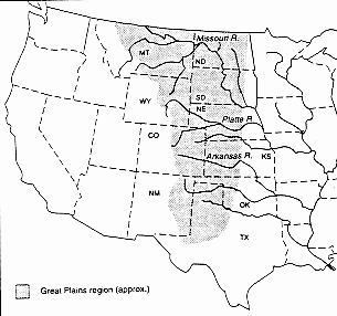
The boundaries of the U.S. Great Plains are variously defined, but we use the one defined by Riebsame (1990) (see Figure 1) which is bounded on the west by the Rocky Mountains, and on the north by Canada's southern border. The other boundaries are based on changes in climate and vegetation type. The east boundary is the edge of the bluestem area and the south boundary is the edge of the desert/scrub. The Great Plains includes portions of 10 states (Montana, North Dakota, Wyoming, South Dakota, Nebraska, Colorado, Kansas, New Mexico, Oklahoma, and Texas) and occupies the central third of the land mass of the United States. The area covered is roughly 1.3 million km2. There are currently 6.2 million inhabitants of the Great Plains with a population density of less than 5 persons/km2 (Riebsame 1990).
Demographics and Socio-Economic Activities
The socio-economic environment of the Great Plains can be characterized by risk and marginality (Riebsame 1990). Since the time of settlement, the variable and semi-arid climate has made it difficult for people to live off the land. This has led to a shift in the population from primarily rural to increasingly urban. Some have described the rural social fabric as thinning (Riebsame 1997). However, the economy is still largely rural, with over half of its counties having populations <2500, and dependent on agriculture for its income (Skold 1997) (see Figure 2 and Table 1). The percentage of rural counties in the Great plains is six times the national average. Thus agriculture is still a dominant lifestyle in this region compared to other regions in the U.S. Narrowing profit margins and technology changes have been driving forces behind the trend in farm consolidation in the Great Plains (Duncan et al. 1995). With farm consolidation, there are fewer farmers left, and more people are moving to the urban centers (see Figure 3).
Figure 1. The Great Plains Region of the United States. Riebsame 1990.

Figure 2. Farm-dependent counties 1989. Drabenstott 1997.
Table 1. The importance of farm production in the Great Plains States, 1989-91 average. Duncan et al. 1995. The values of ranking are the relative ranking of each state to the rest of the USA.
| Rank
out of 50 States |
State |
Share
(percent) |
| 1
2 3 6 7 12 14 17 19 30 |
South Dakota
Nebraska North Dakota Montana Kansas Oklahoma Wyoming New Mexico Colorado National Average Texas |
12.10
9.63 9.33 6.04 3.82 2.73 2.52 2.14 1.91 1.43 1.22 |
| Source: U.S. Department of Commerce, Bureau of Economic Analysis | ||

Figure 3. Great Plains urban and rural population per square mile. Source: U.S. Census Bureau. Riebsame 1990.
Fifty-nine percent of the counties in the Great Plains have lost population in the last 10 years (Duncan et al. 1995). Yet, overall the population of the region has increased by 16% from 1969 to 1991, however less than 20% of this increase was realized outside the urban centers (Skold 1997). These urban centers are thriving as trade locations for broader market regions. This is mainly where the 1990s economic rebound of the Great Plains has been felt (Drabenstott 1997). Real income grew 1.3% a year from 1980 to 1992, mainly in these urban areas, with the Great Plains as a whole showing lower per capita incomes than the national average. Employment has grown by 1% in the period from 1990-1994, which is about 40% less than the national average (Duncan et al. 1995) (see Table 2 and Figure 4). Economic rebound gains have been concentrated in a little over 1/3 of the rural counties, mainly those that are in scenic areas or near urban centers. Growth centers tend to be trade centers, with neighboring communities declining. Small size and remoteness of rural areas have proven to be liabilities (Drabenstott 1997). Many rural economies and governments are considered to be unsustainable (NRCS 1996).
Table 2. Economic performance of Great Plains Counties, 1980-92 (US benchmark). Duncan et al. 1995.
|
Share of population in 1992 |
No. of counties |
Annual growth rate, 1980-92
Per Capita: | |||
| Population | Real income | Employment | |||
| Nonmetro counties
Winners Neutral Losers |
51.7
3.5 21.6 26.7 |
375
12 221 142 |
-0.34
1.60 -0.55 -0.40 |
2.11
2.31 3.43 0.22 |
0.32
3.39 0.37 -0.07 |
| Farming
Manufacturing Mining Government Retirement Trade Other Mixed |
13.8
0.9 3.7 7.6 1.4 21.4 0.2 2.6 |
212
3 16 28 4 94 2 16 |
-1.14
-0.11 0.11 0.35 0.71 -0.37 -1.32 1.44 |
2.98
0.58 0.13 1.11 0.61 0.93 1.62 2.08 |
-0.34
0.60 0.31 0.96 0.83 0.23 -0.42 3.01 |
| Metro counties | 48.3 | 21 | 1.14 | 0.18 | 1.74 |
| All Great Plains counties | 2.7 | 396 | 0.34 | 1.99 | 0.98 |
| All U.S. counties
U.S. nonmetro counties U.S. metro counties |
100.0
22.6 77.4 |
3,078
2,359 719 |
0.96
0.46 1.11 |
1.40
1.46 1.24 |
1.70
1.24 1.82 |
| Note: "Winners" are counties with per capita income growth and employment growth above the U.S. nonmetro average. "Neutral" counties are those with per capita income
growth or employment growth above the U.S. nonmetro average. "Losers" are counties with per capita income growth and employment growth below the U.S.
nonmetro average.
Source: U.S. Department of Commerce. | |||||

Figure 4. Rural Employment Growth in United States. Drabenstott 1997.
Agriculture has been the base of the economy in the Great Plains despite the constraints of the environment. The east to west gradient of declining moisture has determined the crop production for the area. The variability of this climate has been overcome somewhat with technology (fertilizer, irrigation, new crop varieties, etc.). Most farmers are wheat producers, but increasingly farm cash receipts are coming from livestock operations moving into the area. Livestock is capturing a greater economic share of agricultural enterprises of the Great Plains with cattle, hogs, dairy and other livestock enterprises representing 2/3 of the total cash receipts in the heartland states (Figure 5, Drabenstott 1997). Sixty percent of the cattle industry is now concentrated in three Great Plains states, Nebraska, Kansas and Texas (Figure 6). This industry is attracted by the dry climate, which allows feedlot cattle to thrive, and the open space far from population centers that allows for waste disposal (Drabenstott 1997, Hubbard 1997).

Figure 5. Share of Heartland Cash Receipts. Drabenstott 1997.

Figure 6. U.S. Cattle Slaughter 1996. Drabenstott 1997.
The variable market contributes to the agricultural economy's instability. Market outputs have followed the declining precipitation gradient from east to west (see Figure 7 and Figure 11). Because the Great Plains has more marginal land and variable yields, the farmers are more vulnerable to market swings (see Figure 8), with the international markets affecting the area even more than the national markets. The buffer in the past has been government subsidy programs, but these are being reduced. According to Drabenstott (1997), this is going to be a market era. "Farmers are going to live and die by what they plant, not by farming the program." (Drabenstott 1997). A positive sign for the farmers is a strong world food demand, and reduced world grain inventories, which is increasingly becoming the driver for land use decisions (see Figure 9). Nevertheless, there is the threat of international competition as evidenced by a declining trend in real wheat prices since 1955 (see Figure 10).

Figure 7. Market Value of Agricultural Products, Northern Plains Region. NRCS 1996.

Figure 8. Kansas Wheat Yield Volatility, 1950-1996. Drabenstott 1997.

Figure 9. World Wheat Production, Consumption and Trade, 1960-1995. Antle 1997.

Figure 10. U.S. Wheat Prices 1955-1995 and Trend Forecast to 2020. Antle 1997.
Climate and Environment
The continental climate of the Great Plains is characterized by two primary gradients which define the area and determine its environment; these are precipitation (decreasing east to west) and temperature (decreasing south to north) (see Figure 11). They have interacted to affect human settlement and use of the area (Riebsame 1990) Total annual precipitation ranges from 30 inches in the east to less than 15 inches in the west (800 to 250 mm) (Hubbard 1997, Parton et al. 1994). Precipitation is low in winter and high in summer. Temperatures are lowest in January-February and highest in July-August. Soils are fertile, but susceptible to erosion (both wind and water) especially when the plant inputs are reduced (see Figure 12). The growing season varies from 110 days in the north to approximately 300 days in the south (Skold 1997).

Figure 11. Gradients of (a) mean annual precipitation and (b) mean annual temperature in Central United States. Schimel et al. 1990.

Figure 12. Total Annual Soil Loss by Land Use in the Northern Plains (USDA/NRCS 1994). NRCS 1996.
The lack of moisture results in a steppe or semi-arid grassland ecosystem which has evolved under frequent fires, persistent grazing pressures, and extreme weather, including droughts and floods. Much of the natural vegetation has been transformed to crop and rangeland, and altered by other human impacts such as tree-planting for windbreaks. Plant growth is limited by precipitation and nutrient availability (Parton et al.1994) (see Figure 13). The combination of precipitation, temperature, and wind characteristics of the Great Plains leads to extreme weather patterns, including droughts, floods, blizzards, tornadoes and hail. These factors make crop and livestock production in the area highly vulnerable. Drought has always been a factor in these grasslands, with the degree and timing controlled by temperature, precipitation, and the ratio of precipitation to potential evapotranspiration (Parton et al.1994).

Figure 13. Aboveground net primary production and mean annual precipitation at 52 grassland sites in North American grasslands are represented by dots, others by stars (Lauenroth 1979, Parton et al. 1994).
Despite these limitations, humans have managed to transform this area through their use of technological fixes such as irrigation and residue management in overcoming various setbacks. The Dust Bowl of the 1930s shows an extreme example of the social disruption caused by mismanagement of this type of environment. The experiences of the Dust Bowl led to significant improvements in land practices (reduced tillage, land retirement) that have prevented a disaster of that scale again. While the environment has constrained land uses, technology has overcome some of the constraints, but not without problems. This has resulted in a broad transformation of the original landscape by humans (see Table 3). Some of the environmental problems resulting from urban and agricultural practices include siltation of waterways from erosion, increased salinization from irrigation, increased alkalinity of soil, reduced carbon storage of soil, and increased runoff (see Figure 14 and 15). A 1980 USDA study estimated 16% of the cropland exhibited serious water erosion and 25% showed significant wind erosion (Riebsame 1990). Ten percent of the Northern Great Plains landscapes are affected by salinity with a 10% annual increase (NRCS 1996 and Riebsame 1990) (see Figure 16). "Tillage pan" from soil compaction is found in half of the cultivated land in the region (Riebsame 1990).
Table 3. Major human transformations of the Great Plains. Riebsame 1990.
| Transformation | Areal extent | Dispersion | Naturalness |
| Tillage, cropping | Regional | Diffuse | Seminatural |
| Tree planting | Subregional | Concentrated | Seminatural |
| Runoff change | Subregional | Diffuse | Seminatural |
| Water impoundment | Local | Concentrated | Nonnatural |
| Groundwater depletion | Subregional | Diffuse | Nonnatural |
| Soil structure change | Regional | Diffuse | Nonnatural |
| Soil chemistry change | Regional | Diffuse | Nonnatural |
| Soil and water pollution | Regional | Diffuse | Nonnatural |

Figure 14. Simulated levels of soil organic carbon as a function of mean annual air temperature (MAAT) and precipitation (MAP) in the Great Plains. A) Native grasslands on fine-textured soils.
B) Croplands on find-textured soils after 40 years of cultivation in wheat-fallow (Cole et al., 1989) NRCS 1996.

Figure 15. Projected peak runoff rates for different land covers in the central Great Plains. Source: Allis 1948. Riebsame 1990.

Figure 16. Salinity affected landscapes of the Northern Plains Region. NRCS 1996.
Land Use Systems
Agriculture is the primary land use transforming the Great Plains grassland, while urban and industrial uses are increasingly becoming secondary factors. Over 90% of the land is in farms and ranches, and about 40% is cultivated (Riebsame 1990) (see Figure 17). Agriculture is more important to the Great Plains region than to any other region in the country.
There are five major production systems in the Great Plains:
- range livestock,
- crop-fallow,
- groundwater irrigation (aquifer-dependent),
- river valley irrigation (snowmelt-dependent), and
- confined livestock feeding (Skold 1997).
Great Plains agriculture is land-extensive and uses relatively few chemical inputs and labor per unit of land (Antle 1997).
The crops grown vary according to the climatic gradients of rainfall and temperature (see Figure 18). Rainfed corn and soybeans are produced in the east, dryland wheat and sorghum in the west. As productivity decreases along this east-west moisture gradient, risk increases. Spring wheat is planted in the north and winter wheat in the south. Cool season (C3) plants do better further north than warm season (C4) plants (Terri and Stowe 198_, Tieszen et al. 1996, Parton et al. 1994). Increasing irrigation to the west allows more corn production. Rangeland grazing is concentrated in the drier areas to the west. Wheat is considered the "indicator species" of the Great Plains, with its changes in production area reflecting various forces at play during different periods (see Figure 19). The Great Plains is the most productive dryland wheat area in the world, and pivotal to world grain supplies (Riebsame 1990). Great Plains production accounts for 51% of the nation's wheat, 40% of its sorghum, 36% of its barley, 22% of its cotton, 14% of its oats, and 13% of its corn. It produces 40% of the nation's cattle (Skold 1997).

Figure 17. Uses of nonfederal land in the Northern Plains (USDA/NRCS, 1994). *Miscellaneous use includes CRP. NRCS 1996.

Figure 18. Agricultural diversity of the Northern Plains Region. NRCS 1996.

Figure 19. Total Great Plains wheat area. Sources: U.S. Census Bureau, U.S. Department of Agriculture, and state statistics. Riebsame 1990.
Agricultural operations are becoming larger, more corporate in structure, and more dependent on technological advances. Great Plains farms are on average three times larger than farms in other regions of the U.S. (Skold 1997). As mentioned earlier, feedlot operations are also increasing in the Great Plains. Undiversified agriculture has been the trend resulting from policy and market pressures, and from technological advances. This uniformity has contributed to an increase in weeds, pest problems, and loss of natural biodiversity. These changes in agricultural management have enabled the development of highly productive agricultural systems, but have also resulted in greater dependence on technological advances and greater vulnerability to environmental change.
While there has been some improvement in land management practices through conservation measures (e.g., fallow, minimum tillage) to reduce soil loss, increase soil moisture, and stabilize wetlands, much of the area was found to be in need of conservation treatment by a 1992 National Resource Inventory study (45% of cropland, 68% of irrigated land, 62% of rangeland) (NRCS 1996). Nine percent of the rangeland is considered in decline, while two percent is improving (see Figure 20).

Figure 20. Apparent trends in the quality of rangeland in the Northern Plains (USDA/NRCS, 1994). NRCS 1996.
Even though more farm land continues to be lost to other uses, such as preserves, industry, infrastructure and urban development, crop acreage is not declining, as indicated by the fact that the maximum cultivated acreage was reached in 1983 (Riebsame 1990). The Conservation Reserve Program (CRP) has kept much of the marginal land out of production (40-45% of all CRP land is in the Great Plains, >40% of Great Plains wheat acreage is in CRP), but may or may not continue into the future (Drabenstott 1997, Antle 1997). Market demands, prices, policy, and other factors may determine whether this buffer program is maintained. As mentioned earlier, changing agricultural policy in the U.S. will affect land use decisions. Crop acreages could fluctuate dramatically in the future (Drabenstott 1997).
Land use development patterns of the Great Plains have shown a strong bias towards growth (see Figure 21). Riebsame (1990) explains, "The dominant historical pattern of Great Plains agricultural development is its consistent trend toward both expansion and intensification of dryland small-grains production and marketing by owner-operated ("family") farms. Except for minor set-backs, this pattern has been insensitive to negative feedback from the environment ... and from the economy.... This persistent pattern of development is better explained as the result of historical social values, institutions, and symbols, rather than the guiding force of Darwinian adaptational mechanisms." Farmers have made use of technological improvements (e.g. irrigation, fertilizer, conservation practices) to overcome physical constraints (e.g. droughts, low nutrients, wind). In turn, they have affected the physical characteristics of the area and even the climate through such things as: weather modification, greenhouse gas production, increased runoff, pollution and overuse of groundwater, changing soil structure, and loss of soil carbon (see Figure 22). Social policies and lifestyle choice have been driving forces behind land use decisions as well, with the result that Great Plains farmers are not necessarily economic optimalists.

Figure 21. Total Great Plains cropland. Sources: U.S. Census Bureau and state statistics. Riebsame 1990.

Figure 22. The climate forcing by U.S. agriculture related to that by other activities on the globe. To compare the contribution of different activities to climate change requires a single measure called climate forcing. It combines estimates of emissions of the various greenhouse gases by each activity with the absorption of long-wave radiation from the earth and the estimated lifetime in the atmosphere of each gas. In this figure, climate forcing is expressed as the percentage of the forcing during the next 100 years by the 1990 global emission of three gases. For example, emissions of methane from the globe are 27% of all forcing, and methane from U.S. farming is 0.4% of all forcing. U.S. Agriculture's emissions of all the three gases is 0.8% of the global forcing from the three gases. Council for Agricultural Science and Technology 1992.
Water Issues
By virtue of its scarcity, water has been mentioned as a critical component in each of the above three sections describing the socio-economic activities, climate and land use patterns of the Great Plains today. Although this region is characteristically dry, humans have managed to transform the land to overcome this limitation. Because water has been a central component of that transformation, the issue of a continuous, sufficient supply of water is of major concern to the inhabitants. Water supply sources include rain, surface water in rivers, streams and lakes, primarily from snowmelt, and groundwater in aquifers. These flows have been altered by humans through diversion, impoundment, and irrigation for urban and agricultural uses. Rainfall is not sufficient, even with existing surface water impoundment facilities, to support the food production systems there now, particularly in the western portion of the Plains, . There is some but not a great amount. Considerable supplementation has been through irrigation from aquifers, which makes their depletion a serious concern.
As agriculture is the primary economic activity in the Plains, it is not surprising that it is also the main user of water. Eighty percent of the consumptive use of water in the arid west is estimated to be by agriculture. One tenth of the 200 million acres of cropland in the Great Plains are irrigated (Skold 1997). In 1982, 12% of the Great Plains cropland was irrigated, over half of which was with groundwater (Riebsame 1990). The South Platte River Basin alone has over 30,000 wells providing 30% of the water used for agriculture (Garcia 1997). Depletion of the aquifers is associated with the increased use of irrigation. Irrigated land increased more than fourfold, from 3.5 million acres in 1950 to 15 million acres, in 1990 (Opie 1996). The other uses of water in this region are urban or domestic use, wildlife habitat and recreation. The Platte River is critical for migratory waterfowl and shorebirds food and habitat. The prairie pothole area in North Dakota has suffered greatly from loss of wetland habitats.
Nearly all freshwater ecosystems in the Great Plains have been modified by human activities and land uses, including habitat destruction from dams, diversions, and channelizations, altered groundwater flow patterns as a result of pumping, erosion and the alteration of thermal regimes. Point and non-point source pollution have introduced a wide array of organic chemicals, toxic metals, and fertilizers such as nitrogen and phosphorous into the ecosystem. Alteration of vegetation, introduction of non-native plant and animal species, and over-harvesting of native species have also damaged the aquatic ecosystem (Baron 1997). Considerable pollution results from sedimentation and fertilizer, pesticide and waste runoff. This results in increased salinity, nutrient loading, turbidity, and siltation of streams. Shallow aquifers also suffer from these pollution problems (NRCS 1996). Agricultural runoff contributes 2/3 of the river pollution and � of the lake and reservoir pollution in this country (Garcia 1997). Drinking water quality is reduced as a result of pollution, particularly in small towns. This decrease in water quality has affected food production, human drinking water supplies and wildlife habitat.
Water shortage is already a problem. Most water is distributed by "prior appropriation" laws, but costly litigation results from numerous water rights battles. Also, these laws sometimes inhibit or prevent efficient use of the water which could be derived through better management practices (Garcia 1997). Water supply issues will become increasingly important where competition between urban development and agricultural uses is increasing.
In light of the water issues presented above, the following trends that can be expected for the Great Plains region:
Increased size and reduced number of farms (see Figure 23)
Greater responsiveness to extra-regional market demands
Increased importance of technology
Increased livestock operations
Continued water competition between agriculture and urban (see Figure 24)

Figure 23. Total number of commercial farms on the Great Plains. Sources: U.S. Census Bureau and the state statistics. Riebsame 1990.


Figure 24. Agriculture and Urban Land Transfer of Water Rights. Left: Colorado-Big Thompson Project 25 year water rights transfer from farming to cities for domestic and industrial use. Right: Salt River Project, Arizona 38 year land and accompanying rights transfer from farming to urban. Council for Agricultural Science and Technology 1992.
SOURCES CITED:
Antle, John M. 1997. Climate Change and Economic Constraints Facing Great Plains Agriculture. 6 p. Briefing Document for Great Plains Climate Change Workshop 5/97.
Baron, Jill. 1997. Effects of Climate Change on In-Stream Biology and Freshwater Ecosystems. Briefing Document for Great Plains Climate Change Workshop 5/97.
Council for Agricultural Science and Technology. 1992. Preparing U.S. Agriculture for Global Climate Change. Task Force Report #119.
F Drabenstott, Mark. 1997. Economic factors affecting agronomic systems within the Great Plains. Presentation at Great Plains Climate Change Workshop 5/27/97.
Duncan, Marvin, Dennis Fisher, and Mark Drabenstott. 1995. Planning for a Sustainable Future in the Great Plains. Pages 23-42 in Donald A. Wilhite, Deborah A. Wood, and Kelly Helm Smith. Proceedings of the Symposium 'Planning for a Sustainable Future: The Case of the North American Great Plains'. IDIC Technical Report Series 95-1.
Garcia, Luis. 1997. Limits to Water. Presentation at Great Plains Climate Change Workshop 5/27/97.
Hubbard, Ken. 1997. Great Plains Region: Climate System Characteristics. Presentation at Great Plains Climate Change Workshop 5/27/97.
Lauenroth, W.K. 1979. Grassland Primary Production: North American Grasslands in Perspective. in French, N.R.(ed.), Perspectives in Grassland Ecology: Results and Applications of the US/IBP Grassland Biome Study, Springer-Verlag, New York, pp. 3-24.
NRCS, Northern Plains Regional Office. 1996. State of the Land for the Northern Plains Region. USDA, Natural Resources Conservation Service, orthern Plains Regional Office, Lincoln, NE. 64 p.
Opie, John. 1996. Does its history doom the Plains to failure? Putting chaos theory to work. Pages 5-18 in Cathy Bruce and Lori Triplett. The Great Plains Symposium 1996: The Ogallala Aquifer: Sharing the Knowledge for the Future. The Great Plains Foundation.
Parton, William J., Dennis S. Ojima, and David S. Schimel. 1994. Environmental Change in Grasslands: Assessment Using Models. Climate Change 28:111-141.
Riebsame, William E. 1990. The United States Great Plains. Ch. 34, pages 561-575 in B.L. Turner II et al., The Earth as Transformed by Human Action. Cambridge University Press, NY.
Riebsame, William E. 1997. Links between climate change, vulnerability, and coping strategies to environmental and socio-economic changes. Presentation at Great Plains Climate Change Workshop 5/27/97.
Schimel, D.S., W.J. Parton, T.G.F. Kittel, D.S. Ojima, and C.V. Cole. 1990. Grassland biogeochemistry: Links to atmospheric processes. Climatic Change 17:13-25.
Skold, Melvin D. Agricultural Systems and Economic Characteristics of the Great Plains. 4 p. Briefing Document for Great Plains Climate Change Workshop 5/97.
Tebbel, Paul. 1997. Implications of Climate Change on Critical Economic and Natural Resources... Briefing Document for Great Plains Climate Change Workshop 5/97.
Terri, J.A. and Stowe, L.G. 1976. Climatic Patterns and Distribution of C4 Grasses in North America, Oceologia(Berl.) 23,1-12.
Waltman, W.J., H.R. Sinclair, and S.W. Waltman. 1997. Characterizing and Mapping Soil Climate in the Northern Plains Region. Briefing Document for Great Plains Climate Change Workshop 5/97.