   |
||||||
|
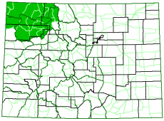
Wildlife managers that set population objectives for wildlife in Colorado,
and the researchers that provide information to the managers, have been
hoping for many years to include a strong habitat component. The
Colorado Wildlife Habitat Assessment Project has made
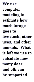
that possible. Our project uses modeling with computerized maps that
include how much food is produced, and how much is needed by animals,
to estimate how many elk and deer should be in an area. We do that
based on the wildlife's wintering habitat, the time of year when they
are most food-stressed. The logic is that if they are provided with
adequate forage through the winter, finding enough forage through the
other seasons will be easier.
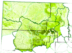
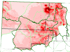
One way to understand how the model works is through the spatial data it uses. We will use images from the Northwestern Habitat Assessment Model Application to illustrate. The data include a:
Forage Production Map
Livestock Offtake Map
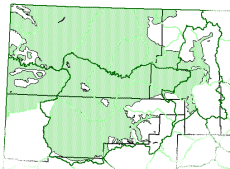
The Colorado Division of Wildlife creates maps showing the winter distributions of elk, deer, and other wildlife species. HPP committees help us update the maps, if necessary, then we use them in modeling. With these important layers, plus other information, in place, we then use a spatial modeling process. We subtract from the forage that is available, the forage that livestock will use. We then subtract an amount of forage that should stay on the landscape, to keep the system sustainable. This component of forage is used by small animals, is decomposed to enrich the soil, protects against excessive runoff and flooding, etc. We then remove forage that may be used by other wildlife species, such as pronghorn or wild horses. Lastly, we use whatever forage is left to calculate how many elk and deer may be supported. There are more details about what we do, such as different levels of forage production based on rainfall and different estimates for elk and deer based on whether managers are risky or conservative, but the general idea has been described. For more detail, you may read a write-up by N.T. Hobbs that describes the general approach. Our manual, provided on the products page provides the most detail. Feel free to contact us if you have further questions.
| |||||