|
References
| |
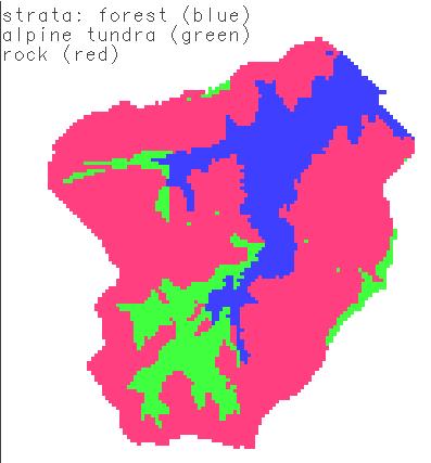
Loch Vale watershed strata delineations:
red=rock; green=alpine tundra; blue=forest
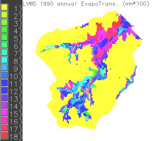
LVWS 1990 annual ET (mm*100)
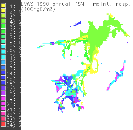
LVWS 1990 annual (gross PSN - maint. resp.) in gC/m2*100
Estimates of Loch Vale productivities and
evapotranspiration from references
| |
Englemann Spruce/Subalpine fir forest |
Tundra (many est. from Niwot Ridge, CO) |
reference |
| area (approx.) |
40 hectares |
100 hectares |
|
| ET (not incl. sublimation) |
500 mm/year |
220-270 mm/year |
Baron and Denning, 1991 |
| above-ground net PSN |
289 gC/m2
(a) |
100-300 gC/m2
(b) |
a) Arthur, 1991.
b) Bowman and Fisk, 2001. |
| below-ground net PSN |
151gC/m2
(a) |
170-370 gC/m2
(b) |
| total PSN |
~440 gC/m2 |
~300-500gC/m2 |
| |
|
|
RHESSys simulated ET is too large for
both forest and tundra (~2-3x too large).
RHESSys simulated PSN is about right for
forest, too high for tundra (~4x too high)
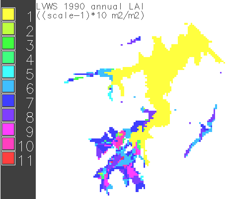
LAI should be a maximum of 7 in the forest and 2 for alpine tundra.
LAI looks good for the forest, and is 50-100 times too large for
tundra.
|