Below are the pathways of all the animals we are tracking throughout the Loita Plains and the Maasai Mara region of Kenya. They are shown with different colors for each animal, and with labels of the animals' collar numbers. Pathways are overlaid upon a satellite image and a map of the highways and topography of the area. Click on an image to enlarge it, and use the "Back" button on your browser to return to this page.


|
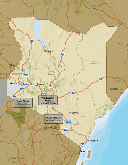
To the right is a map of Kenya, with the areas in which we have GPS collars on wildebeest shaded in green.
To view the individual pathways close-up, return to the Tracking page, and follow the links to individual animals or click on the other study area boundaries to view the movements of the wildebeest that we are tracking in the other two protected areas.
Information used as backdrops on these pages come from the ArcGIS World Imagery service, and the ArcGIS World Street Map service. Our thanks to them for providing this service.
|